Investigators:
Leonard C. Ferrington, University of Minnesota
Susan Gresens, Towson University, Baltimore, Maryland
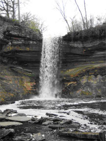
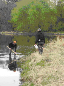
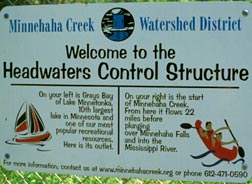
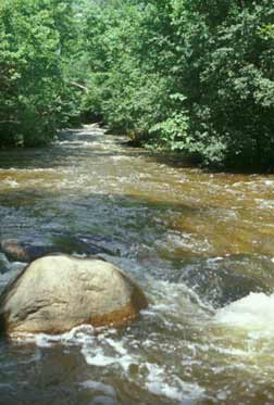
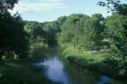
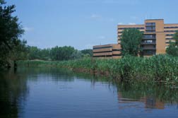
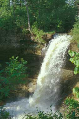
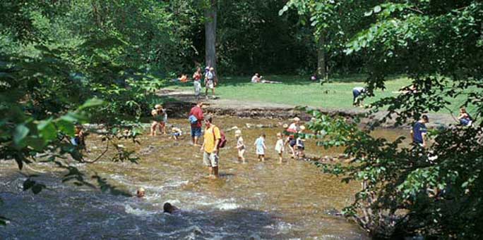
Minnehaha Creek is a valued recreational and esthetic resource for local neighborhoods as it flows through parks and urban areas from Lake Minnetonka to where it joins with the Mississippi River. In 2003 we initiated a study to determine the biological diversity of non-biting midges (Diptera: Chironomidae) in the creek. Fourteen sites were sampled on a three-week interval for surface-floating pupal exuviae of Chironomidae. This method is described in Ferrington et al. (1991) The first set of samples was taken immediately after the stream thawed in April and sampling continued through summer and into winter of 2003 when the stream began to freeze over. A total of 168 samples were taken.
At this time we have processed and quantified all samples from three of the 14 sites. The remaining samples are still being sorted and the specimens counted, slide mounted and identified. We have already documented 124 species occurring in the stream. Most sites have at least 60 species and the total for one site exceeds 90 species!
Voucher collections are being made of each species, which we expect will exceed 124 species when all samples from all sites are identified. Data will be entered into EXCEL spreadsheets and standard metrics used in water quality monitoring programs will be computed for each sample date and cumulatively for each of the 14 sample sites.
A longer-term goal of this research project is to develop an identification guide to Chironomidae of Minnehaha Creek that includes both original drawings and digital photographs of all species collected in the stream. Our intention is that the key will also include annotations that focus on morphological features of the species, and a one-paragraph summary of the biology of the species, if known. We will indicate the site(s) where each species has been collected, information on its periods of emergence and the peak emergence date(s). However, our project budget is presently insufficient to cover costs for this longer-term goal and we will need to develop additional funding sources to complete the key. We estimate that it will take approximately one additional year to write, annotate and produce the key.
Minnehaha Creek Sample Sites
Project Status and Summary as of 12 January 2005
Fourteen sample sites (See details, below)
Sample dates: 9 April 2003, 29 April 2003, 21 May 2003, 11 June 2003, 2 July 2003, 22 July 2003, 8 August 2003, 27 August 2003, 19-20 September 2003, 7 October 2003, 1-2 November 2003, 22 November 2003
Total number of samples= 168
Total estimated species detected to date= 124
Sites, Locations, Lattitude, Longitude, Elevation, Number Samples Sorted, Species Detected
Site 1: Near confluence with Mississippi River
N44° 54.585’ W93° 12.140’ 702 ft.
Four samples identified— 53 species
Site 2: First site downstream Falls
N44° 54.737’ W93° 12.413’ 742 ft.
Three samples identified— 49 species
Site 3: Immediately Upstream Falls
N44° 54.930’ W93° 12.716’ 802 ft.
Three samples identified— 53 species
Site 4: 32nd Avenue
N44° 55.046’ W93° 13.463’ 815 ft.
Three samples identified— 55 species
Site 5: Upstream Lake Nokomis Park
N44° 54.906’ W93° 14.809’ 817 ft.
Three samples identified— 52 species
Site 6: Chicago Avenue
N44° 54.667’ W93° 15.774’ 830 ft.
Three samples identified— 48 species
Site 7: Near Pratt Avenue
N44° 54.361’ W93° 16.773’ 834 ft.
Four samples identified— 46 species
Site 8: Near Confluence of Outflow Lake Harriet Outflow w/ Minnehaha Creek
N44° 54.650’ W93° 17.887’ 846 ft.
All samples sorted
Site 9: Outflow Lake Harriet in park North of West 50th Street
N44° 54.783’ W93° 17.887’ 856 ft.
All samples sorted
Site 10: Upton Avenue South
N44° 54.337’ W93° 18.862’ 846 ft.
All samples sorted
Site 11: In park @ intersection Browndale Ave. & west 50th Street.
N44° 54.682’ W93° 20.450’ 886 ft.
All samples sorted
Site 12: Excelsior BLVD, by hospital
N44° 55.626’ W93° 21.780’ 908 ft.
All samples identified— 88 species
Site 13: West 34th Street, downstream of bridge
N44° 56.536’ W93° 23.624’ 925 ft.
All samples sorted
Site 14: Bridge Street, Minnetonka
N44° 56.507’ W93° 26.701’ 931 ft.
All samples identified— 101 species